![]()
 | |
|
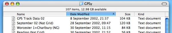
7 November 2007 Five years of GPS mappingHere's an anniversary I should have blogged earlier this year. In August 2002, Ben Jameson, Andrew Bolt, Matthew Slattery, Robert Brown and I, sitting in the bar of a Caledonian MacBrayne ferry from Colonsay to Oban, hatched a plan for a user-editable website with maps made from GPS tracks. In September, I bought a Garmin eTrex in Keswick, a serial cable from eBay, and a USB adapter from a computer dealer in South Wales; recorded my first GPS tracks; downloaded them; converted them into an Illustrator file; and started on the map. I've still got the tracks:
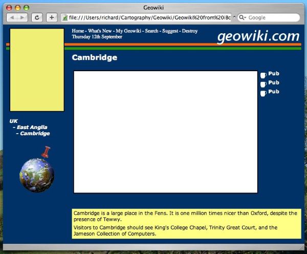
In mid-September, I wrote some HTML for a website mockup:
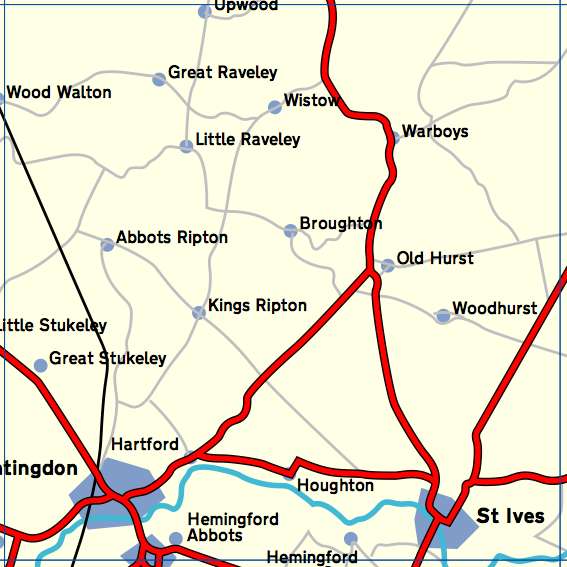
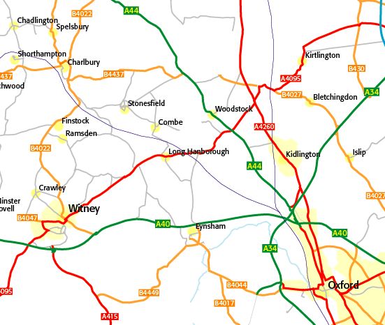
(I wish I could remember what the 'Destroy' option was meant to do.) By early November - five years ago as I write this - I'd made this map using GPS tracks, Illustrator, and scans from an out-of-copyright map:
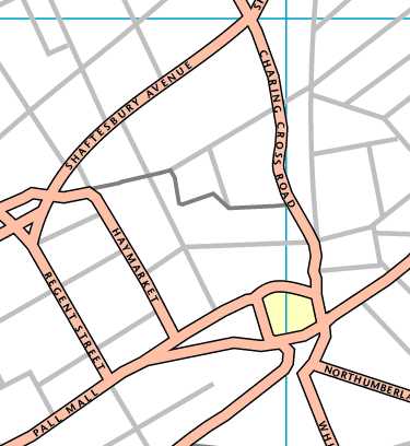
and using similar methods, was working on one of London:
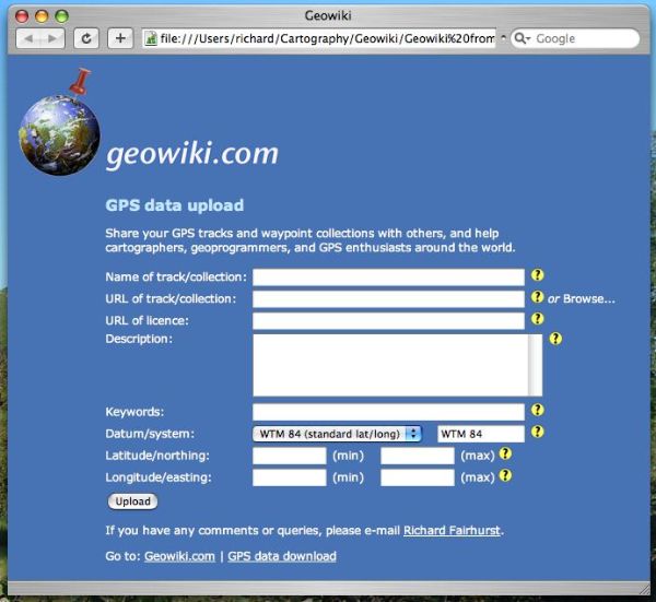
There were some collaborative features in there that look ordinary now, but were pretty cool back then:
(Looking back on my notes, I'm amused to read: "Enter a licence URL, or leave blank for no restrictions. We suggest you think carefully before choosing a licence, such as the GPL, which restricts further use of your file.". Plus ca change...) Early in 2003 I imported roads, coastline, and built-up areas from the Digital Chart of the World, or VMAP0, which I'd downloaded at work and brought home. Coupled with roads from an increasing number of GPX tracks, it was starting to look like a real mapping website.
geowiki.com sneaked onto the web that spring with nary a fanfare. And, of course, Geowiki itself never became front-page news, but free GPS mapping certainly did. Thousands of people are now uploading tracks to the web - my personal tally is well over 20,000 miles now - and making a big, big map out of them; and a small core of very, very talented enthusiasts are producing the genius code, renderings, events, and community that drive it all. We all take a while to settle into the roles that best suit us. Five years on I'm pretty happy with my role as a cog in the open mapping machine and OpenStreetMap in particular. I get to do a lot of cartography and UI-led application design. I get to learn cool stuff - ActionScript, for example, and how to do stuff with SRTM. (It still makes me giggle to think that Geowiki is entirely flat files because I didn't actually know what SQL was.) And I have a lot of fun throwing ideas out there, especially when some of them stick - like, "let's map the National Cycle Network". Yet there's never so much that I can't do all the other things I enjoy: if Geowiki as a site was to get anywhere then there'd have been a lot less of the fun stuff, and a lot more of the sort of bullshit that ended up exasperating me so much at Waterscape. And the best bit? I have absolutely no idea what will happen in the next five years. Maybe it's time to do something new with the Geowiki domains? Comments |
SitesGeowiki PeopleClare Bampton ElsewhereBisbrooke AboutFeeds
|